Udemy - Future Land Use with GIS - TerrSet - CA Markov - ArcGIS
"softddl.org"
1-10-2021, 17:12
-
Share on social networks:
-
Download for free: Udemy -
-

MP4 | Video: h264, 1280x720 | Audio: AAC, 44.1 KHz
Language: English | Size: 2.88 GB | Duration: 4h 3m
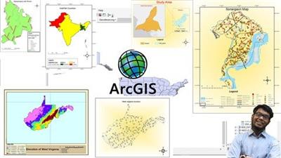
CA Markov Model Machine Learning Approach. ArcGIS Erdas QGIS used for data Preparation and TerrSet for Prediction GIS

MP4 | Video: h264, 1280x720 | Audio: AAC, 44.1 KHz
Language: English | Size: 2.88 GB | Duration: 4h 3m
CA Markov Model Machine Learning Approach. ArcGIS Erdas QGIS used for data Preparation and TerrSet for Prediction GIS
What you'll learn
You will be able to
Predict future expansion of urban area and generate future map.
Understand Advance concept of GIS and hands on
Advance concept In ArcGIS and Terrset Software
Understand Working with DEM
Running Advance Queries in GIS
Handling complex data of GIS
CA Markov Model
See Machine Learning in Action
Validation of Generated Results
Other Related task to GIS like UTM Zone, Mosaic of Digital Elevation Model
You Must know Basic of GIS
Familiar with ArcGIS, ERDAS Just basics
You Must have software Terrset and ArcGIS both are NOT Open Source. You need to manage.
Must know how to prepare land use. This is advanced course. Otherwise first learn Landuse mapping using other course.
You must have two landuse with Good Accuracy
Description
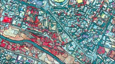
In this course you will see Machine learning in Action using readymade land Change model Terrset (formerly IDRISI ) . This course used Terrset Software with CA Markov method to predict future landuse ArcGIS is used to prepare data. Erdas also used for some task. No coding is used .All software used in this course are NOT Open Source. You need to manage software. You must know to prepare landuse maps rest of things covered in this course from scratch. Future prediction of landuse depends on number of drivers/Parameters. Drives means forces which decide how the future urban area will look. It includes many drives like, old city boundary because new settlement will be constructed near to old city boundary. Roads and relief are also one of factors, because first roads near city covered by settlement. On another side how, much possibility at different location on agriculture site that can be convert to urban. Similarly, forest cover also. We also need to avoid some landuse classed like water, river, lake or reservoir never convert to urban. So, we need to setup our model in such a way so that it avoids water. After setting accuracy of learning and output accuracy also matters. We also need to modify it. In this course we have achieved learning accuracy of 42%, and 67% in two different runs. But 89% accuracy we have achieved in predicted landuse. Learning and prediction accuracy is different on computer to computer and data to data. While running you will receive more or less accuracy then this course. But focus on your output results. If Learning accuracy was 100% then it also wrong. So, see and understand each video carefully. Then run you model. You must see free preview video before enrolling this course. Because this is Expert level course.
Note: Who having IDRISI Taiga They can also follow same steps.
This course covers 90% Practical and 10% Theory.
Don't hesitate to ask me Questions in QA Session.
Who this course is for:
Water Resource Engineers
Urban Planner
Land Mangement teams
Student of GIS Masters and Phd Level
Student of Remote Sensing
Civil Enginners
Remote Sensing and GIS Project Scientist
Homepage
https://www.udemy.com/course/prediction-of-future-land-use-remote-sensing-and-gis-terrset/Buy Premium From My Links To Get Resumable Support,Max Speed & Support Me
https://hot4share.com/ol65gb3rgn25/134tx.Future.Land.Use.with.GIS..TerrSet..CA.Markov..ArcGIS.part1.rar.html
https://hot4share.com/zodd9lmou0jk/134tx.Future.Land.Use.with.GIS..TerrSet..CA.Markov..ArcGIS.part2.rar.html

https://uploadgig.com/file/download/953476211a858d08/134tx.Future.Land.Use.with.GIS..TerrSet..CA.Markov..ArcGIS.part1.rar
https://uploadgig.com/file/download/21E4D6b94133Ce04/134tx.Future.Land.Use.with.GIS..TerrSet..CA.Markov..ArcGIS.part2.rar

https://rapidgator.net/file/5b242065791bcd73224afcf24c6011da/134tx.Future.Land.Use.with.GIS..TerrSet..CA.Markov..ArcGIS.part1.rar.html
https://rapidgator.net/file/8cad01207e1c63a9a85d64a1a3f8b322/134tx.Future.Land.Use.with.GIS..TerrSet..CA.Markov..ArcGIS.part2.rar.html
Links are Interchangeable - No Password - Single Extraction
The minimum comment length is 50 characters. comments are moderated


